
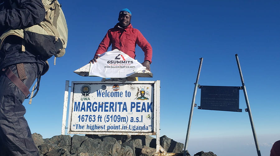
Conquer Margherita Peak (5,109 m) – the highest point in Uganda and the 3rd highest mountain in Africa – on this epic 12-day adventure along the Uganda–DR Congo border in the legendary “Mountains of the Moon”.
This demanding yet technically moderate trek takes you through one of the most extraordinary and least-visited mountain ranges on the planet – a UNESCO World Heritage Site famous for its surreal giant vegetation, perpetual mist and breathtaking glacial peaks.
Details
Day 1 - Arrival at Entebbe airport
As per the appointment with discovery Slayers Uganda, journey is by day, or any time of the day flight to Entebbe. After the late arrival in EBB, the transfer to the hotel in Kampala takes place by the company representative.
In the afternoon we can explore the immediate vicinity of the hotel on foot.
Day 2 - Entebbe town/ Kampala - Kasese town
The drive on the north route is long; on the way we get first impressions of the life of the population. The well-developed road winds through extensive hill country with loose acacia forests, passes extensive tea plantations and small water-filled depressions with a dense population of papyrus. At lunchtime we take a break in a restaurant on the route. In the afternoon we arrive in Kasese and move into our hotel. Here we sort our equipment, prepare the mountain luggage and we can still do one or two errands in town. Kasese is the meeting point for all Rwenzori mountaineers from all over the world. From the veranda of our hotel we enjoy the first glimpses of the Rwenzori Mountains.
Day 3 - Kasese Town - Ibanda - Nyabitaba Hut
After breakfast, we will store the luggage that is not required at the hotel. (Attach name tags to the pockets). After a short drive we reach Nyakalengija (1,615 m), a village near Ibanda, our starting point for the Rwenzori ascent. With our escort team (guides, cooks and porters) we make the final preparations; the luggage is weighed and distributed. We leave around noon or early. Along the banks of the Mubuku (a source river of the Nile) and past the fields of the Bakonjo mountain farmers, we find our way through tall elephant grass and thick bush. On the steep bank slopes of the Mubuku we hike up and down through tropical forest, twice we cross the river on bridges. The last part of the approximately four-hour stage leads steeply up a ridge to which, like all accommodations in the Rwenzori National Park, very simple Nyabitaba hut (2,650 m). From here we have a nice view of the Portal Peaks.
Day 4 - Nyabitaba Hut - John Matte Hut
Today’s stage is characterized by fantastic and lush vegetation. First the route leads down to the Mubuku River and a little further upstream, then at the confluence of the Mubuku and Bujuku over a suspension bridge to the other bank. A newly laid wooden staircase helps us over the steep bank slope. Muddy forest floor, slippery roots and slippery rocks: this is pure jungle and correspondingly exhausting in rainy weather. At an altitude of about 3,000 m we meet the first Senecia. Continuously up and down, we reach the Nyamileju refuge after about 5 hours. This is where the bleaching moss zone, Bigo Bog, with the tussock grass begins. Another hour and our destination for the day, the John Matte Hut (3,480 m), is in sight. We walk through a beautiful Senecien forest, past huge flowers,
Day 5 - John Matte Hut - Bujuku Hut
As soon as we have crossed the Bujuku River on rocks, we go on a newly constructed boardwalk through the “Lower Bog”, a large plain with lots of swamp and tussock grass. Then we climb over roots and through mud, past long lichens and thick moss up the steep mountain slopes. The “Upper Bog”, a high valley, the texture of which is similar to that of the “Lower Bog”, extends at around 3,400 m. Walking forward sometimes means laborious “hopping forward” from tuft to tuft of grass; sometimes a piece of boardwalk leads through the moor. The mostly irregular movement through mud and morass costs strength and concentration. On the way we come across the river again, which we cross several times today. The route leads steeply through Bigo Bog and dense Senecia forest up to Lake Bujuku and on to Bujuku Hut (3,970 m). The hut is located a little above the lake in the middle of a light Senecia forest with high grass cover and, in good weather, offers wonderful views of Lake Bujuku, Mt. Baker, the Stanley massif and Mt. Speke. Incidentally, the Ruwenzori massif consists of six mountain parts. The highest peaks are with the twin peaks Margherita (5,109 m) and Alexandra (4,990 m) in the Stanley group.
Day 6 - Bujuku Hut - Elena Hut (mountaineer)
At the beginning through Bigo Bog, we climb a boggy hill through dense Senecien forest. We climb over tree trunks and under them. Because of the altitude, we have to walk slowly and steadily. A long metal ladder takes us to a good vantage point, from which we can look over the entire basin with the Bujuku Lake on fog-free days. This is where our paths separate: Today, the Ruwenzori aspirants climb in another 2 hours to the Elena Hut (4,540 m) below the Elena Glacier. Depending on the weather conditions, you have the opportunity to climb the summit twice (tomorrow and the day after tomorrow). The luggage and food are carried up by porters who then return to the Bujuku hut.
Day 7 - Ascent of the Margherita peak (mountaineer)
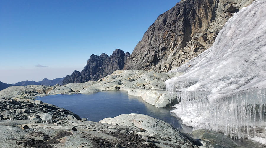
Very early in the morning, around 4 a.m., the climbers set off for the glacier equipped with headlamps. The first stage leads from the Elena hut over rock terraces (rock climbing difficulty levels I to II). A fixed rope is attached in a steeper area. To the west towards the glacier it gets very up to the Stanley Plateau (this is where the crampons are used). At approx. 4,800 m, past the rock walls of the Alexandraspitze, there is a short descent through a steep rock channel. A metal ladder facilitates the transition down to the glacier. Then we climb again steeply up the glacier until we reach the pass between Alexandra- and Margheritaspitze. Just under an hour and a key point separate us from the summit. The last rocks on the way to the summit require climbing skills up to II +, a fixed rope is usually attached here. Depending on the weather conditions, we reach the summit after 5 – 7 hours. We have a fantastic view of the surrounding mountains and into the Congo. We descend to the Elena hut in about 3 hours. Discuss with your guide depending on your energy if you can proceed to Kitandara hut, if not possible have an overnight in Elena hut and descend the following morning.
Day 8 - Kitandara lakes / reserve day (mountaineer)
If the weather was good yesterday and if the ascent to the Margherita peak was successful, a leisurely descent to the Kitandara lakes awaits the climbers. With today’s summit storm, however, it will be a long day: We have to cope with the ascent to Margherita and the descent to the lake, so even with good conditions a 13-14 hour stage!
Day 9 - Kitandara Hut - Guy Yeoman Hut
We have to leave early so that there is enough time to rest on the way, because we have a long day ahead of us. Roots and rocks characterize the steep ascent in serpentines to the Fresh field Pass (4,280 m), which in good weather allows a wonderful view down to the Kitandara Lakes and the Edward Glacier on Mt. Baker. The descent is also steep – and also slippery, stamina and stamina are again required here. The path leads down into a river valley; we need about three hours for the arduous stage. This is followed by a fairly flat, but very long Bigo Bog section, then a steep section of the path that leads through mud, over large rocks and tree trunks. Today we need a lot of stamina, because this section of the route makes extreme demands on the psyche at times. A first cave appears in the mist between large, lush green ferns, mosses and lichens. It is the Bujongolo Cave, where the Duke of Abruzzo’s expedition set up camp in 1906. Along the steep rock walls with huge rock caves everything is dripping with moisture. The path over slippery rocks and slippery wooden ladders requires full concentration. The last 1-hour stage leads on a flat route through a beautiful high valley along the meandering river through lobelia forest to the Guy Yeoman hut (3,450 m). The path over slippery rocks and slippery wooden ladders requires full concentration. The last 1-hour stage leads on a flat route through a beautiful high valley along the meandering river through lobelia forest to the Guy Yeoman hut (3,450 m). The path over slippery rocks and slippery wooden ladders requires full concentration. The last 1-hour stage leads on a flat route through a beautiful high valley along the meandering river through lobelia forest to the Guy Yeoman hut (3,450 m).
Day 10 - Guy Yeoman Hut - Kasese Town
We start very early. On the last stage we descend through beautiful rainforest; then a not so easy descent at a waterfall and over the Kichuchu rock, which requires a head for heights and surefootedness, to the Kichuchu cave. The following flat, swampy section of the path is difficult. We have to be careful and keep our balance so as not to slip on the slippery surface. We alternately hike through dense undergrowth, meter-high bamboo forest covered with moss and lichen, and through head-high ferns. At the Nyabitaba hut we come across our ascent route and walk back to the starting point or end point of the mountain tour to Ibanda in two to three hours. We say goodbye to our companions, distribute the tips and drive to the hotel in Kasese. Here we dry our wet clothes, enjoy a hot shower and the feeling of being clean again. Dinner rounds off our day and we fall into bed tired.
Day 11 - Kasese town - Entebbe airport, Flight home or to your other travel destination
After breakfast we drive to Entebbe together and have the day at leisure if your light is late night, we pass the capital city of Uganda and enjoy a foot walk, get to a restaurant to enjoy your last meal in Kampala before your final transfer to the airport.
